Space News & Blog Articles
India’s PSLV launches with two Singaporean satellites
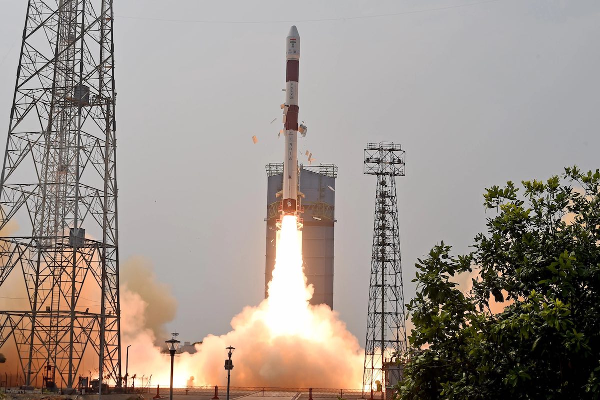
 India’s Polar Satellite Launch Vehicle lifts off from the Satish Dhawan Space Center on Saturday. Credit: ISRO
An Indian Polar Satellite Launch Vehicle lifted off Saturday and flew to an altitude of more than 360 miles (580 kilometers) to deploy two Singaporean satellites, one for all-weather radar imaging surveillance and another for technology demonstrations.
The PSLV took off from the Satish Dhawan Space Center on India’s east coast at 4:49 a.m. EDT (0849 UTC) to begin a 20-minute mission to deploy the two Singaporean satellites. After releasing the two satellites, the rocket’s upper stage was expected to extend power-generating solar panels and continue operating for a month with seven experimental hosted payloads.
The 145-foot-tall (44-meter) rocket vaulted away from its launch pad on Sriharikota Island, located north of the Indian city of Chennai, at 2:19 p.m. local time Saturday. The PSLV flew in its so-called “core alone” configuration without any strap-on boosters. Its solid-fueled core stage produced more than a million pounds of thrust for nearly two minutes, then jettisoned as the second stage lit a hydrazine-fueled Vikas engine to continue accelerating into orbit.
A solid-fueled third stage and liquid-fueled fourth stage finished the job of placing Singapore’s TeLEOS 2 and Lumelite 4 satellites into orbit. The PSLV’s fourth stage released the TeLEOS 2 radar imaging satellite, the larger of the two payloads, about 19-and-a-half minutes into the mission. Less than a minute later, the smaller Lumelite 4 spacecraft deployed from the rocket.
“The PSLV has placed both of the satellites, TeLEOS 2 and Lumelite, into the intended orbit,” said S. Somanath, chairman of the Indian Space Research Organization.
The rocket targeted an orbit about 364 miles (586 kilometers) above Earth at an inclination of 10 degrees to the equator. The unusual low-inclination orbit will allow the TeLEOS 2 radar remote sensing satellite to more frequently observe Singapore and neighboring regions. Most radar imaging satellites fly in higher-inclination orbits for more global Earth observation coverage.
TeLEOS 2 will provide high-resolution imagery for the Singaporean government and commercial users. The spacecraft was developed by ST Engineering, a Singaporean defense and technology company, in partnership with the Defense Science and Technology Agency, the acquisitions and systems development division for the Singapore Armed Forces.
NewSpace India Ltd., the commercial arm of ISRO, arranged for the launch of TeLEOS 2 and Lumelite 4 with their Singaporean owners.
“The PSLV has once again demonstrated its high reliability and its suitability for commercial missions of this class,” Somanath said after Saturday’s launch.
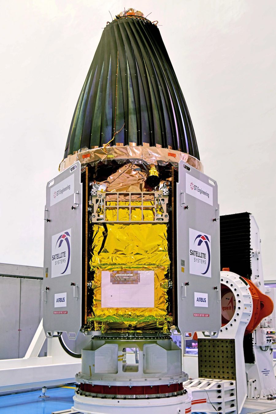
 Singapore’s TeLEOS 2 radar satellite during pre-flight preparations at the Indian launch site. The radar antenna on the TeLEOS 2 satellite is seen stowed in its launch configuration. Credit: ISRO
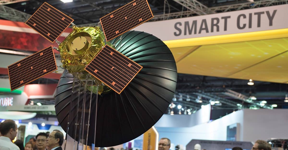
The 1,633-pound (741-kilogram) TeLEOS 2 satellite was expected to unfurl its four power-generating solar panels and radar antenna following separation from the upper stage of the PSLV rocket. The synthetic aperture radar instrument, made in Singapore, will transmit radar beams down to Earth and measure the exact time it takes for the signals to reflect back to a receiver on-board the spacecraft.
That information will be used to generate images. Radar remote sensing offers a benefit over optical Earth-imaging instruments. Radars can observe the ground through darkness and cloud cover, providing an all-weather, day-and-night imaging capability.
“The development and launch of TeLEOS 2 represent another milestone in our journey in building up indigenous capabilities for the expansion and commercialization of our satellite technologies,” said Low Jin Phang, president of digital systems at ST Engineering. “It will further propel the growth of Singapore’s space industry and strengthen ST Engineering’s position in the global space market.”
TeLEOS 2 will collect radar imagery at 1-meter (3.3-foot) resolution, monitoring shipping routes, disaster zones, and natural resources. The satellite will supply imagery to Singaporean government agencies, including the Civilian Aviation Authority of Singapore, the Ministry of Home Affairs, the Maritime and Port Authority of Singapore, and the National Environment Agency.
Singapore’s Ministry of Defense will also use TeLEOS 2 imagery for military and security purposes.
“TeLEOS 2’s ability to capture images under all weather conditions, during both nighttime and daytime, at an average of 14 passes a day, unlocks multiple possibilities for commercial applications,” said David Tan, executive director of Singapore’s Office for Space Technology and Industry. “This includes hotspot monitoring, oil spill detection, and air and maritime search and rescue operations.”
Last year, an Indian rocket launched a Singaporean optical Earth observation satellite named DS-EO and a radar imaging technology demonstration satellite named NeuSAR. An Indian PSLV rocket launched the TeLEOS 1 optical imaging satellite in 2015.
 A model of the TeLEOS 2 satellite as it will appear in orbit, with solar panels and its radar antenna unfurled. Credit: ST Engineering
The Lumelite 4 satellite flew to space as a rideshare payload on the PSLV mission Saturday. Developed by the National University of Singapore’s Satellite Technology and Research Center, the 35-pound (16-kilogram) Lumelite 4 will test a VHF Data Exchange System payload designed to improve real-time ship tracking, and maritime ship-to-ship and ship-to-port communications.
After deploying the TeLEOS 2 and Lumelite 4 satellites, the PSLV’s upper stage was expected to transform into a hosted payload platform. There are seven experiment and tech demo packages on the PSLV’s fourth stage, including an on-board computer, an ionospheric research instrument, an electric propulsion system, an experimental star tracker system for small satellites, and a new CubeSat deployment mechanism.
The launch Saturday marked the 57th flight of a Polar Satellite Launch Vehicle since 1993, and India’s third space launch of the year.
This email address is being protected from spambots. You need JavaScript enabled to view it. the author.
Follow Stephen Clark on Twitter: @StephenClark1.
When you subscribe to the SpaceZE News Feed, we will send you an e-mail when there are new updates on the site so you wouldn't miss them.

